
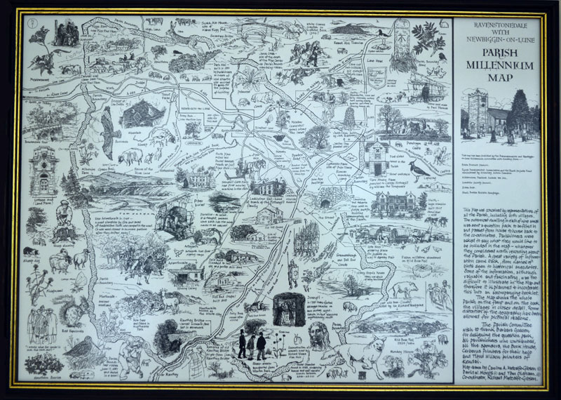
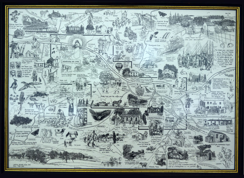
The Millennium Map for the parish of Ravenstonedale is a double sided map consisting of pen and ink drawings of Ravenstonedale with a millennium theme. The map was illustrated by local artists David Morris, Caroline Metcalf-Gibson and Tom Oldham and took 3 years to complete. It was a lottery funded project completed in the summer of 2001. The map measures 59.5cm x 42cm and copies can be purchased from the Scar Art Gallery in Ravenstonedale.
There is also an interactive version of the map - interactive map.
The interactive map contains hotspots that, when clicked, display the original contributions to the Millennium Map from the inhabitants of Ravenstonedale Parish in the year 2000. Links from the interactive map are listed here...
beckstones, blacksmiths, bleaflatt lane, dubbs, elm lodge, fell end chapel, green bell, kilnmire, manor house, new chapel, park house farm, primitive methodist chapel, pump house, roads, stone faces, town herad cottage, weasdale, weasdale 2, weasdale 3.
Side 1. Drawings depicting the Parish
Side 2 Drawings of the 2 Villages
 Prior
to the turn of the century the government indicated that grants
would be made available from National Lottery funds to sponsor
projects to mark the millennium around the UK. The idea of
creating a millennium map orginated in the summer of 1998
in response to this government initiative. The idea of creating a map originally came from Caroline Metcalf
Gibson. Caroline, together with Hilary Mirrey and others,
convened a meeting in the summer of 1998 to discuss this and
other ideas for which funding might be available to the benefit
of the parish.
Prior
to the turn of the century the government indicated that grants
would be made available from National Lottery funds to sponsor
projects to mark the millennium around the UK. The idea of
creating a millennium map orginated in the summer of 1998
in response to this government initiative. The idea of creating a map originally came from Caroline Metcalf
Gibson. Caroline, together with Hilary Mirrey and others,
convened a meeting in the summer of 1998 to discuss this and
other ideas for which funding might be available to the benefit
of the parish.
Following the meeting in the summer of 1998 a steering group was formed to drive the map project forwards. This group consisted of David Morris, Caroline Metcalf-Gibson, Barbara Godden, Dick Capel, John Bull, Ken Trimmer and Richard Metcalf-Gibson. Tom Oldham later joined the group. Richard Metcalf-Gibson co-ordinated the project.
03.03.2000
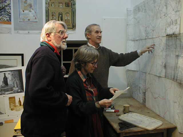
Richard, David and Caroline study maps of the parish
in March 2000 with a view to creating an outline drawing of
a parish map on which to place labels representing contributions
from parishioners. Click on image to enlarge.
03.03.2000
The first label goes on to the map in March 2000.
Click on image to enlarge.

10.03.2000
One week later the number of labels has increased dramatically.
Click on image to enlarge.

03.03.2000
The steering group examine commercial maps for ideas on how to produce the Ravenstonedale parish map.
Click on image to enlarge.

25.10.2000
Working on the map in October 2000.
Click on image to enlarge.

25.10.2000
The map takes shape in October 2000.
Click on image to enlarge.

25.10.2000
Detail from map as it was in October 2000.
Click on image to enlarge.
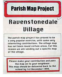
The contributions returned on the 9 questionnaires made fascinating reading and the group quickly determined that they should all be used in creating the map. However it proved difficult to devise how some contributions could be transformed into illustrations to be used on the map and consequently the idea of publishing a booklet to accompany the map was envisaged. The booklet was to contain all contibutions in their original form without adaptations. This decision was taken in order to retain the feeling of warmth and involvement evident in many of the contributions so giving an insight into the character of some local people at the time of the millennium. The booklet was eventually published by Chris Irwin of The Book House, Ravenstonedale.
David Morris, Caroline Metcalf-Gibson, Tom Oldham